
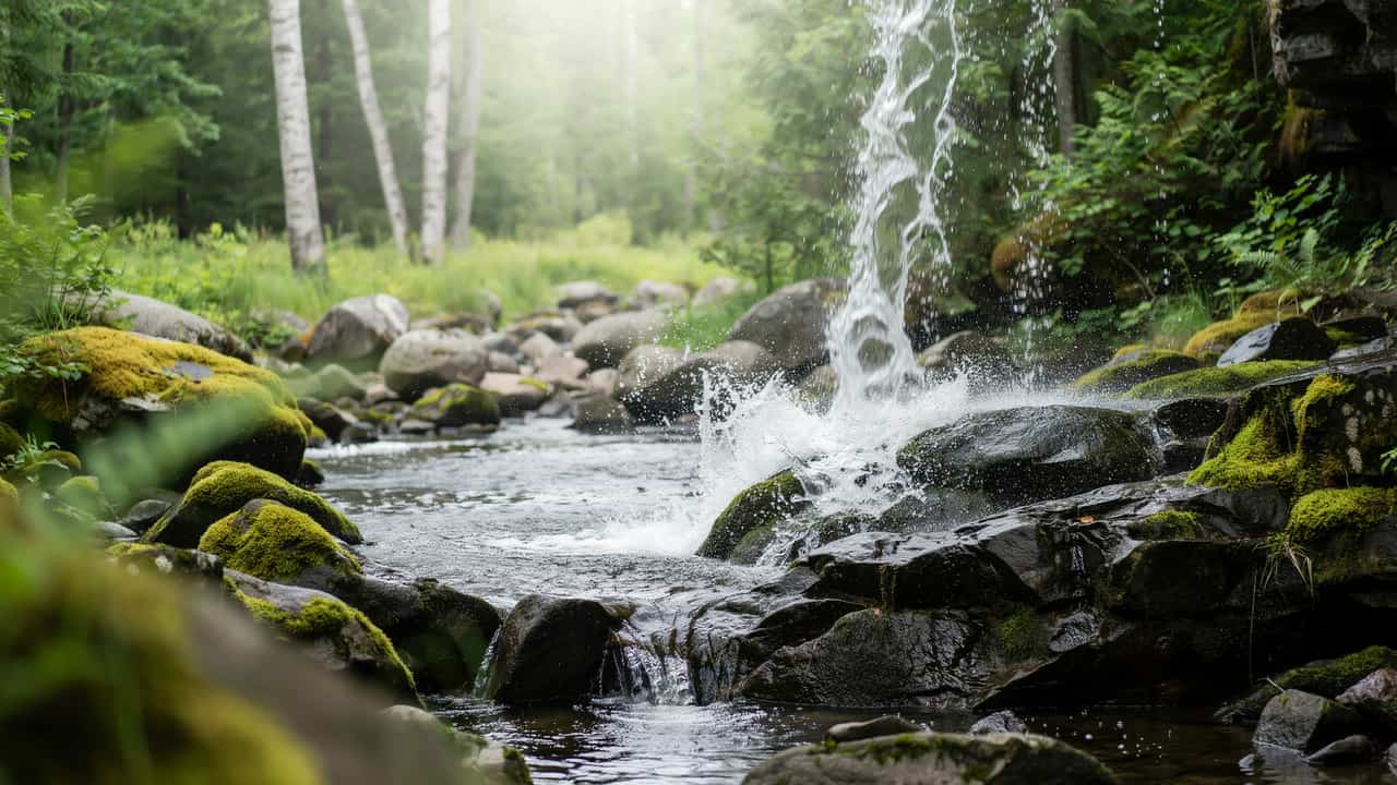
The Upper Peninsula is Michigan at its biggest and wildest. Cross the Mackinac Bridge and you enter a region of painted sandstone cliffs on Lake Superior, more than 300 waterfalls, freighters passing through the Soo Locks, old copper and iron mines, and the largest state park in Michigan. It is also a region of long distances, so a trip here works best when you pick a corner or two and give each some time.
Use this guide as your starting point. It explains how we define the region, compares thirteen towns side by side, and highlights what each does best. It also covers the big parks, a park pass decoder, sample itineraries, a season planner, getting around and safety basics. Each town section links to our full guide for that town.
What Counts as the Upper Peninsula?
The Upper Peninsula, or U.P., is the part of Michigan north of Lake Michigan and Lake Huron, reached from the Lower Peninsula by the five-mile Mackinac Bridge, which opened in 1957 and links Mackinaw City with St. Ignace. People who live here are called Yoopers. The U.P. is bordered by Lake Superior to the north, Lake Michigan to the south, and Wisconsin to the west, with the St. Marys River and the Canadian border at Sault Ste. Marie.
On InsideMichigan, we cover the whole peninsula in this guide, and we split it into four travel corners, from east to west: the Eastern U.P. (St. Ignace, Sault Ste. Marie and Tahquamenon Falls), the Lake Superior shore (Munising and Marquette), the Keweenaw Peninsula and Copper Country, and the Western and southern U.P. (Ironwood, Iron Mountain, Escanaba and Manistique). Heading back south? See our Northern Michigan guide.
The Upper Peninsula at a Glance
| Best for | Waterfalls, Lake Superior cliffs and beaches, freighter watching, mining history, lighthouses, wilderness hiking, fall color and winter sports |
|---|---|
| Main towns | St. Ignace, Sault Ste. Marie, Newberry, Munising, Marquette, Houghton, Hancock, Calumet, Copper Harbor, Ironwood, Iron Mountain, Escanaba, Manistique |
| Getting there | The Mackinac Bridge from the Lower Peninsula; US-2 along Lake Michigan; I-75 to Sault Ste. Marie; US-41 and M-28 across the peninsula; the International Bridge to Ontario |
| Best seasons | Summer for cruises, hiking and lighthouses; October for fall color; winter for skiing and ski jumping |
| Planning tip | Distances are long and cell service can be spotty. Pick one or two corners per trip. |
| Pairs well with | Northern Michigan across the Mackinac Bridge |
Which Upper Peninsula Town Is Right for You?
Each town has a different personality. Use this table to match the trip you want with the right base.
| Town | Best for | Don’t miss |
|---|---|---|
| St. Ignace | The gateway town and Mackinac Island ferries | Castle Rock; Museum of Ojibwa Culture; Straits State Park |
| Sault Ste. Marie | Freighters, locks and Michigan’s oldest city | Soo Locks Park; Tower of History; Museum Ship Valley Camp |
| Newberry | The gateway to Tahquamenon Falls | Tahquamenon Falls State Park; Whitefish Point |
| Munising | Pictured Rocks cruises and waterfalls | Pictured Rocks National Lakeshore; Miners Castle |
| Marquette | The U.P.’s largest city, with trails, beaches and a college-town vibe | Presque Isle Park; Iron Ore Heritage Trail; Sugarloaf Mountain |
| Houghton | A Keweenaw base on the Portage Lake waterway | McLain State Park; Isle Royale seaplane flights |
| Hancock | Copper mining history across the lift bridge | Quincy Mine and its hoist |
| Calumet | Copper Country history | Keweenaw National Historical Park headquarters |
| Copper Harbor | The end of the road, with a fort and a scenic drive | Fort Wilkins; Brockway Mountain Drive; Isle Royale ferry |
| Ironwood | The western U.P. and Porcupine Mountains access | Black River Scenic Byway; Hiawatha statue |
| Iron Mountain | Mining history and winter sports | Cornish Pumping Engine; Pine Mountain Ski Jump |
| Escanaba | Little Bay de Noc and a long downtown | Sand Point Lighthouse; Ludington Park |
| Manistique | A Lake Michigan harbor town and a famous spring | Kitch-iti-kipi at Palms Book State Park |
Explore the Upper Peninsula Town by Town
We start at the Mackinac Bridge and work through the Eastern U.P., then west along Lake Superior to the Keweenaw, and finish in the western and southern U.P.
St. Ignace: The Gateway Town
St. Ignace sits at the northern end of the Mackinac Bridge, a five-mile suspension span that opened in 1957. It is a main ferry port for Mackinac Island, with service from the downtown harbor until ice forms in late December or early January. Straits State Park, just outside town, offers views of the bridge, hiking trails and campsites, and it holds the Father Marquette National Memorial. Four miles north, Castle Rock was an ancient lookout and still offers a scenic view.
The Museum of Ojibwa Culture and Marquette Mission Park fill a former church with artifacts and art, and the Fort de Buade Museum covers regional history. Each Labor Day morning, thousands take part in the Mackinac Bridge Walk. Good to know: Book Mackinac Island ferries early in summer. Read our St. Ignace guide →
Sault Ste. Marie: Locks, Freighters and Michigan’s Oldest City
Sault Ste. Marie is Michigan’s oldest city, and its main draw is the Soo Locks, which let ships bypass the St. Marys River rapids and overcome a 21-foot difference in water level. According to the local visitors bureau, about 10,000 freighters pass through each year. My family and I have been to the Soo Locks and we’ve watched massive freighters lifted up in them. The Soo Locks Park is open year-round, and the visitor center is seasonal, with an observation deck close to the action. You can also ride a boat tour through the locks.
The Tower of History rises 210 feet over downtown (open May to October), the River of History Museum covers 8,000 years of local history, and the Museum Ship Valley Camp, a retired Great Lakes freighter, is full of nautical exhibits. The International Bridge connects to Sault Ste. Marie, Ontario.
Good to know: Sault Ste. Marie averages about 120 inches of snow each year, so plan winter trips accordingly. Read our Sault Ste. Marie guide →
Newberry: The Gateway to Tahquamenon Falls
Newberry is the base town for Tahquamenon Falls State Park, Michigan’s second-largest state park. The Upper Falls are more than 200 feet wide with a drop of roughly 50 feet, making them among the largest falls east of the Mississippi River. The Lower Falls, about five miles downriver, are a series of five cascades. A paved trail leads to the Upper Falls overlooks. Read our Tahquamenon Falls guide →
North of the park, Whitefish Point is home to the Great Lakes Shipwreck Museum, the Whitefish Point Light Tower (the oldest operating lighthouse on Lake Superior) and a bird observatory. The Newberry Logging Museum is about three miles north of town on M-123.
Good to know: Tahquamenon Falls requires a Recreation Passport for vehicle entry. Read our Newberry guide →
Munising: Pictured Rocks Cruises and Waterfalls
Munising is the main base for Pictured Rocks National Lakeshore, which stretches 42 miles along Lake Superior and was designated in 1966 as the first national lakeshore in the United States. The multicolored sandstone cliffs, arches and formations, including Miners Castle, Chapel Rock and Grand Portal Point, are best seen from the water, and narrated boat cruises and kayak tours leave from Munising. Miners Castle is the one cliff area you can reach by car.
On land, Miners Falls is a short hike to a 40-foot waterfall, and Miners Beach has about a mile of sand. Farther east, the Grand Sable Dunes rise more than 300 feet above the lake, and Sable Falls drops 75 feet near Grand Marais. Grand Island, just offshore, is a separate national recreation area. Read our Pictured Rocks guide →
Good to know: Pictured Rocks charges no entrance or day-use fees, but cruises are ticketed separately and run seasonally. Check trail closures, since storm damage in 2025 closed the Munising Falls trail. Read our Munising guide →
Marquette: The Upper Peninsula’s Largest City
Marquette, with about 21,000 residents, is the biggest city in the U.P. and home to Northern Michigan University. Its history comes from iron ore, and the Lower Harbor Ore Dock is a downtown landmark. Presque Isle Park is a 323-acre peninsula with forest trails, a loop road and Black Rocks, the dark cliffs where the lake meets the shore. Cliff jumping is popular here but risky, and the water is very cold. The park is also a popular spot to watch for the northern lights.
The 47-mile Iron Ore Heritage Trail runs from Republic to Chocolay Township for walking, biking and winter sports. The Marquette Maritime Museum and Harbor Lighthouse offer tours from mid-May to early October, and the free Michigan Iron Industry Museum sits in nearby Negaunee. Sugarloaf Mountain is a short hike with a big view, and Marquette Mountain has been skiing since the 1950s.
Good to know: Munising is about 30 minutes southeast of Marquette, so the two combine easily. Read our Marquette guide →
Houghton: A Base for the Keweenaw
Houghton sits on the Keweenaw Waterway and is the base town for the Copper Country, home to Michigan Technological University. A short drive north, McLain State Park offers Lake Superior shoreline and sunsets. Houghton is also the departure point for seaplane flights to Isle Royale National Park, a quick option compared with the ferry from Copper Harbor.
Good to know: Keweenaw towns have no public transportation to speak of, so rent a car. The Keweenaw also sees heavy snow in winter. Read our Houghton guide →
Hancock: Quincy Mine and the Lift Bridge
Houghton and Hancock face each other across the Keweenaw Waterway, linked by the Portage Lake Lift Bridge, which carries US-41. Climbing the hill out of Hancock, you come to the Quincy Mine, a site in Keweenaw National Historical Park. The mine’s restored hoist is the centerpiece, and a cog-rail tram descends the steep hillside with views of both cities. Underground and surface tours are offered in season, with ticket prices that vary.
Good to know: Admission fees at the mine are paid on site. Read our Hancock guide →
Calumet: The Heart of Copper Country History
Calumet is the headquarters of Keweenaw National Historical Park, which includes just under two dozen sites stretching from Copper Harbor to south of Ontonagon. The historical park’s sites operate independently of the National Park Service. Nearby villages such as Kearsarge, Wolverine and Copper City tell the same story of copper boom and bust. Along US-41 north of Calumet, a snow-depth marker called the Snomometer is a roadside curiosity that hints at how much snow the Keweenaw gets.
Good to know: The Cliff Mine site, the most productive copper mine in the United States from 1845 to 1854, is farther north on the peninsula. Read our Calumet guide →
Copper Harbor: The End of the Road
Copper Harbor sits at the tip of the Keweenaw Peninsula, where US-41 ends. Fort Wilkins Historic State Park, built by the Army in 1844 to keep peace in the copper country, has restored buildings and costumed interpreters in season, plus camping and hiking. Admission to the fort is free, but a Recreation Passport is required for vehicle entry. Nearby, the Estivant Pines Nature Sanctuary protects old-growth white pine, and Brockway Mountain Drive offers views of Copper Harbor, Lake Superior and, on clear days, Isle Royale.
Copper Harbor is also the launch point for the ferry to Isle Royale National Park, which runs from mid-May to mid-October. The Copper Harbor Lighthouse is reached by boat. Read our Isle Royale guide →
Good to know: Cell service can be limited near Copper Harbor. Read our Copper Harbor guide →
Ironwood: The Western Gateway
Ironwood is the westernmost town in the U.P. Its old-fashioned business district surrounds the art deco Ironwood Theatre, and a 52-foot statue of Hiawatha stands in a hillside park just south of downtown. From Bessemer, the Black River Scenic Byway runs about 15 miles through the woods past a series of waterfalls, including Gabbro, Potawatomi and Gorge Falls, to the Lake Superior shore.
East of the byway, Porcupine Mountains Wilderness State Park is Michigan’s largest state park, with 60,000 acres of old-growth forest, waterfalls, ridges and Lake Superior shoreline. Lake of the Clouds is the signature overlook, and the Presque Isle River corridor is another highlight. The small town of Ontonagon is about 20 miles east of the park. Read our Porcupine Mountains guide →
Good to know: The Porcupine Mountains require a Recreation Passport. Read our Ironwood guide →
Iron Mountain: Mines, Bats and a Ski Jump
Iron Mountain was built on iron ore. The Cornish Pumping Engine and Mining Museum features a steam-driven pumping engine that stands 54 feet tall and weighs more than 700 tons, the largest ever built in the United States. Visitors can also take an underground train tour at the Iron Mountain Iron Mine (open June through mid-October) and, at dusk, watch bats at the Millie Mine, a designated Michigan Wildlife Viewing Area.
The Pine Mountain Ski Jump, built in 1938, now stands at 459 feet and hosts international competitions in late January or early February. The Dickinson County Courthouse, built in 1896, is also worth a look.
Good to know: Iron Mountain is on Central Time, an hour behind most of the U.P. Read our Iron Mountain guide →
Escanaba: Little Bay de Noc
Escanaba sits on Little Bay de Noc and is the largest city on the U.P.’s Lake Michigan shore. Sand Point Lighthouse and a historical museum anchor Ludington Park, and downtown’s Ludington Street is described by the local visitors bureau as the longest and largest downtown in the Upper Peninsula. About 50 minutes east on the Garden Peninsula, Fayette Historic State Park preserves an old iron-smelting town, and the Peninsula Point Lighthouse is another nearby stop.
Good to know: Escanaba is about 65 minutes from Munising. Read our Escanaba guide →
Manistique: Kitch-iti-kipi and the Lake Michigan Shore
Manistique is a harbor town on Lake Michigan, and its biggest draw is about 15 minutes northwest: Palms Book State Park, home to Kitch-iti-kipi, “The Big Spring.” It is Michigan’s largest natural freshwater spring, a clear, roughly 40-foot-deep pool fed by about 10,000 gallons of water a minute. A self-guided observation raft takes visitors across the spring, where you can see trees, branches and trout far below. Swimming and boating are not allowed.
The spring is also a good stop on the way to Pictured Rocks. Indian Lake State Park, the U.P.’s fourth-largest inland lake, is nearby, and Manistique also has a breakwater lighthouse on the harbor.
Good to know: Palms Book State Park requires a Recreation Passport. Read our Manistique guide →
Upper Peninsula Parks and Passes, Decoded
The U.P. has a mix of national, state and local parks, and each has its own entry rules. Use this table as a starting point.
| Place | Near | System | What you need |
|---|---|---|---|
| Pictured Rocks National Lakeshore | Munising and Grand Marais | National Park Service | No entrance or day-use fee; cruises are ticketed separately |
| Isle Royale National Park | Copper Harbor and Houghton | National Park Service | Separate ferry or seaplane ticket and park fees; check nps.gov |
| Keweenaw National Historical Park | Calumet and the Keweenaw | National Park Service with partner sites | Each site has its own admission |
| Tahquamenon Falls State Park | Newberry | Michigan state park | Recreation Passport |
| Porcupine Mountains Wilderness State Park | Ironwood and Ontonagon | Michigan state park | Recreation Passport |
| Palms Book State Park | Manistique | Michigan state park | Recreation Passport |
| Straits State Park | St. Ignace | Michigan state park | Recreation Passport |
| McLain State Park | Houghton | Michigan state park | Recreation Passport |
| Fort Wilkins Historic State Park | Copper Harbor | Michigan state park | Free admission; Recreation Passport for vehicle entry |
| Presque Isle Park | Marquette | City park | Check local rules |
About the Recreation Passport: It grants vehicle entry to all 103 Michigan state parks and recreation areas. For 2026, the Michigan DNR lists the passport at $15 for Michigan-registered vehicles when added during license plate renewal. Out-of-state vehicles pay $42 for an annual pass or $12 for a day pass. You do not need one if you arrive on foot or by bicycle. Prices can change, so confirm on the Michigan DNR website.
Five Sample Upper Peninsula Itineraries
The U.P. is big, so each itinerary stays in one corner. Check hours and seasonal schedules before you go.
Eastern U.P.: Locks and Falls (Sault Ste. Marie to Newberry)
- Day 1: Watch freighters at the Soo Locks Park, take a locks boat tour and climb the Tower of History.
- Day 2: Drive to Whitefish Point for the Shipwreck Museum and lighthouse, then to Tahquamenon Falls for the Upper and Lower Falls.
Lake Superior Shore (Munising and Marquette)
- Day 1: Take a Pictured Rocks cruise from Munising, then stop at Miners Castle and Miners Falls.
- Day 2: Visit the Grand Sable Dunes and Sable Falls near Grand Marais, then head to Marquette.
- Day 3: Spend the day in Marquette: Presque Isle Park, the Lower Harbor Ore Dock and the Iron Ore Heritage Trail.
The Keweenaw (Houghton to Copper Harbor)
- Day 1: Tour the Quincy Mine in Hancock, then walk the Calumet area’s copper heritage sites.
- Day 2: Drive north to Copper Harbor. Visit Fort Wilkins, then drive Brockway Mountain Drive for sunset.
- Day 3: Take the ferry to Isle Royale for a day trip or overnight, in season.
Western U.P. (Ironwood and the Porcupine Mountains)
- Day 1: See Hiawatha in Ironwood, then drive the Black River Scenic Byway to its waterfalls.
- Day 2: Spend the day at Porcupine Mountains Wilderness State Park: Lake of the Clouds overlook and a short hike.
Lake Michigan Shore (St. Ignace, Manistique and Escanaba)
- Day 1: Start at Castle Rock in St. Ignace, then follow US-2 west to Manistique and Kitch-iti-kipi.
- Day 2: Continue to Escanaba for Sand Point Lighthouse and downtown, then to Iron Mountain for the Cornish Pumping Engine.
If It Rains
The U.P.’s indoor options include the Soo Locks Visitor Center and River of History Museum, the Great Lakes Shipwreck Museum, the Michigan Iron Industry Museum and Marquette Maritime Museum, the Keweenaw National Historical Park’s sites, the Cornish Pumping Engine museum and the Museum of Ojibwa Culture.
When to Go: A Season-by-Season Planner
| Season | What’s happening | Planning notes |
|---|---|---|
| Spring | Seasonal sites reopen; Pictured Rocks cruises begin in May; Soo Locks Visitor Center opens in mid-May; Isle Royale ferry begins mid-May | Snow can linger; check trail and road conditions |
| Summer | Hiking, paddling, cruises, lighthouses and mine tours; Tower of History open May to October; U-pick Blueberry Farms | Book lodging early near Pictured Rocks and the Soo |
| Fall | Peak color in October, arriving first in the Keweenaw; northern lights viewing at spots like Presque Isle Park | Some attractions close by mid-October |
| Winter | Skiing at Marquette Mountain and cross-country trails; Pine Mountain ski jumping (late January or early February); heavy snow in the Keweenaw and Sault Ste. Marie | Winter driving can be challenging; many seasonal attractions close |
Getting to and Around the Upper Peninsula
- By road: The Mackinac Bridge is the main entrance. From St. Ignace, I-75 runs north to Sault Ste. Marie, and US-2 follows Lake Michigan west to Escanaba and on toward Iron Mountain and Ironwood. US-41 and M-28 cross the peninsula to Marquette and the Keweenaw.
- Across the border: The International Bridge links Sault Ste. Marie, Michigan, with Sault Ste. Marie, Ontario. Check current U.S. and Canadian border requirements, and bring a valid passport or other approved travel document.
- By ferry and air: Ferries to Mackinac Island leave from St. Ignace. Isle Royale is reached by the ferry from Copper Harbor or by seaplane from Houghton, mid-May to mid-October. Regional airports serve Escanaba and the Keweenaw.
- Time zones: Most of the U.P. is on Eastern Time, but the western counties (including the Iron Mountain and Ironwood area) are on Central Time. Check before you book tours or tickets.
- Distances and connectivity: Allow extra drive time, fill the tank before long stretches and expect intermittent cell service in remote areas.
Lake Superior and Waterfall Safety
Lake Superior is cold, deep and powerful. The National Weather Service and Michigan Sea Grant warn that rip currents and structural currents near piers and breakwalls can be dangerous on the Great Lakes, so keep these basics in mind:
- Check the National Weather Service’s Great Lakes beach hazard forecast and local flag warnings before you swim, and stay away from piers and breakwalls in rough surf.
- Stay behind railings and on marked trails at cliffs and waterfalls. Falls from Pictured Rocks cliffs have been fatal, and cliff jumping at spots like Black Rocks is risky.
- Paddling Lake Superior’s sea caves and cliffs requires experience, a life jacket and a close watch on the weather.
- If you are caught in a rip current, do not fight it. Swim parallel to the shore until you are free.
Upper Peninsula FAQ
What is the Upper Peninsula?
It is the part of Michigan north of Lake Michigan and Lake Huron, separated from the Lower Peninsula by the Straits of Mackinac and linked by the five-mile Mackinac Bridge.
What are the best things to do in the Upper Peninsula?
Popular picks include a Pictured Rocks cruise, Tahquamenon Falls, the Soo Locks, Presque Isle Park in Marquette, the Keweenaw’s mining sites and Brockway Mountain Drive, the Porcupine Mountains and Kitch-iti-kipi.
How many days do you need in the U.P.?
A long weekend covers one corner, such as Munising and Marquette or Sault Ste. Marie and Tahquamenon Falls. A week lets you combine two or three corners.
Is Pictured Rocks free?
The National Park Service charges no entrance or day-use fee at Pictured Rocks, but boat cruises and kayak tours are ticketed separately.
Do I need a Recreation Passport in the U.P.?
Yes, for vehicle entry at Michigan state parks such as Tahquamenon Falls, the Porcupine Mountains and Fort Wilkins. National Park Service sites and city parks follow different rules.
How do I get to Isle Royale?
Isle Royale National Park is reached by ferry from Copper Harbor or by seaplane from Houghton, and the ferry runs from mid-May to mid-October. Check the National Park Service website for current logistics.
Is cell service reliable in the Upper Peninsula?
Not everywhere. Service can be intermittent in remote areas, so download maps and confirm reservations before you set out.
Which time zone is the Upper Peninsula in?
Most of the peninsula is on Eastern Time, but the western counties, including the Iron Mountain and Ironwood areas, are on Central Time.
When is the best time to visit the Upper Peninsula?
Summer is best for cruises, hiking and lighthouses, and October is best for fall color. Winter suits skiers and snow lovers, though many attractions close.
Keep Planning
- Northern Michigan Travel Guide
- Mid-Michigan Travel Guide
- West Michigan: Beaches, Dunes and Lakeshore Towns
- All Michigan Destinations
Sources and Further Reading
We build these guides from official and primary sources wherever possible. Details like hours, prices and festival dates change, so confirm them with the sources below before you go.
- Michigan DNR: Recreation Passport
- Michigan DNR: Porcupine Mountains Wilderness State Park
- Michigan DNR: Palms Book State Park
- National Park Service: Keweenaw County and Isle Royale
- Northern Michigan University: U.P. Heritage Sites, Dickinson County
- National Weather Service: Great Lakes Safety
- Michigan Sea Grant: Dangerous Currents